GenAI Digital Twin
UCLA MobiFuse · SCAG Region
2.1M
Synthetic Agents
4,109
TAZ Zones
MobiFuse
UCLA Framework
SCAG region synthetic population heatmap showing agent distribution across Los Angeles area TAZ zones

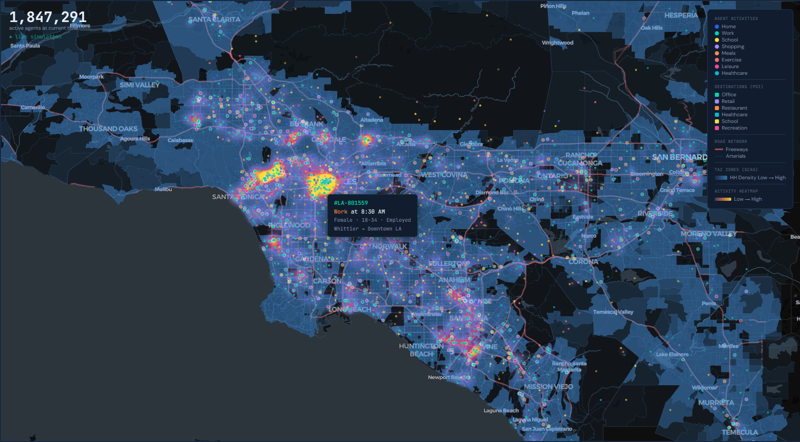
Explore a synthetic population of 2.1 million agents across the SCAG region. Visualize activity patterns by time of day, filter by demographics, and trace individual trip chains — all powered by UCLA's MobiFuse framework.

Open on Desktop for Full Experience
tdm.numobility.ai/digital-twin/
← Platform
DT
GenAI Digital Twin Synthetic Population Explorer
Numobility × UCLA Mobility Lab
Los Angeles County
12a 6a 12p 6p 12a
8:30 AM — Morning Commute
Planner →
Data
Agents
📡
GPS Trajectories
1.0M daily traces · Veraset
MAP: agent activity dots
📌
Points of Interest
847K locations · OpenStreetMap
input to fusion pipeline
📋
TAZ Zones
10,208 Tier 2 zones · SCAG
MAP: TAZ polygon boundaries
👥
Time Use Survey
12 demographic groups · BLS
MAP: activity heatmap
🛣
Road Network
343K links · MATSim
MAP: road hierarchy lines
Generative Data Fusion
Transfer Learning Based Data Fusion
Spatial Information Data Fusion
4.36%
Speed MAPE
Caltrans PeMS · I-405
5.85%
Volume MAPE
Caltrans PeMS · I-405
Trip Length Distribution
25% 15% 5% Share
0 5 mi 10 15 20 25+
Synthetic (UCLA MobiFuse) Survey (NHTS 2017)
Age All Young Mid Elder
Gender All M F
Employ All Worker Non-W
1,847,291
active agents at current time
● live simulation